Canada is not one climate — it's a stack of them, and they open and close on a schedule. A spot that's a frozen no-go in April is the best camp on the continent in July. A northern road that doesn't exist as a driveable surface in May is a gravel highway by late June. Routing across a country this size isn't about a fixed itinerary — it's about reading the calendar and being in the right latitude when each window opens.
This guide is strategic, not a route. It won't tell you to be in Banff on the 14th. It tells you which forces are moving — bugs, thaw, ferry seasons, snow — so you can build your own plan around them and stay comfortable. Pair it with [free camping on Crown land](crown-land-camping.md) for where you can legally stop, and [winter van living](winter-vanlife.md) for when the cold catches you anyway.
The two forces that actually drive the calendar
Strip away the romance and Canadian seasonal routing comes down to two things working against each other:
- Temperature comfort pulls you north and up in summer, south and down (or coastal) in winter.
- Access — whether the road, ferry, or ground will physically let you through — gates when you can chase that comfort.
Most rookie mistakes are access mistakes: showing up north too early and hitting a closed ferry, or driving a forest road during spring breakup and sinking it. Get the access windows right and the comfort takes care of itself.
Spring (April–May): mud season, and the bugs wake up
Spring is the trickiest season to route because the ground is in transition and almost nothing is fully open yet.
Spring breakup / frost laws. As the frost leaves the ground, gravel and forest roads turn soft and provincial transport ministries post seasonal load (frost law) restrictions that cap heavy vehicles at a percentage of their legal axle weight — commonly stepped down to 70%, then 50%, of legal loading until the road firms up (TranBC — Seasonal Load Restrictions; live status on DriveBC). For a heavy van or a truck camper on a remote forest service road, breakup is the season to stay on hard surfaces. A road that's fine in August can swallow a rig in late April. Restrictions are posted by district and change with the thaw each year — check the live provincial load-restriction status before committing to any gravel.
Where to be instead. Spring is when the milder south is comfortable and the north is still locked. Southern BC, the southern Prairies, and southern Ontario are pleasant; this is good "shoulder" country before the heat and crowds arrive.
The bug clock starts. Black flies are the first to emerge. In Ontario's boreal belt they fly as adults from mid-May until late June, primarily during the day, while mosquitoes start mid-to-late May and last into July (Friends of Algonquin Park.php)). The exact start shifts with the weather each year, and it runs later the further north you go. This is the single most underrated routing factor in the country — see the dedicated window below.
The black-fly / mosquito window — route around it
If you've never met a Canadian black fly swarm in a riverside boreal camp, take this seriously. It can turn the best free site in the country into a place you can't stand outside.
- Black flies: roughly mid-May to late June in central Ontario, declining sharply into July (Friends of Algonquin Park.php)). They breed in moving water, so they're worst near rivers and streams.
- Mosquitoes: begin mid-to-late May and last into July, lasting longer than black flies (Friends of Algonquin Park.php)).
- The further north, the later and more intense the whole cycle — peak bug pressure in the territories and northern boreal can run deep into summer.
The strategic move: during peak black-fly weeks, favour open, breezy, drier country — coastlines, ridgelines, alpine, the southern Prairies — over dense wet bush. Wind is your friend; black flies can't fight a stiff breeze. Or simply let the worst of it pass before you push into the deep northern bush, which conveniently lines up with when the northern roads open anyway.
Summer (June–September): the north finally opens
This is the window. Summer is when the highest-value, hardest-to-reach country in Canada becomes driveable — and it's a short window, so timing matters.
Northern and territorial roads. The Dempster Highway — Canada's iconic Arctic road — is realistically a summer drive from about June 10 to mid-October, gated by the Peel and Mackenzie River ferries. Those crossings go offline for roughly 3–5 weeks during spring break-up (and again for 6–8 weeks at fall freeze-up) when neither the ferries nor the ice roads operate (The Dempster Highway — Driving Seasons). Show up in May and you may sit at a river you can't cross. Always check the territorial ferry/ice-crossing status before you commit to the drive (GNWT Infrastructure — Ferries; 511 Yukon).
The takeaway pattern: aim to be staging toward the far north by mid-to-late June, do the deep-north legs in July and August, and be working your way back out by September, before the fall freeze-up window starts closing the river crossings again.
Newfoundland and Labrador are seasonal too. The Marine Atlantic ferry to Argentia, NL only runs mid-June to late September (the year-round crossing is the longer North Sydney–Port aux Basques route) (Marine Atlantic — Schedule). The Strait of Belle Isle crossing to Labrador (St. Barbe–Blanc-Sablon) can be delayed or rerouted by drifting sea ice into spring and early summer — the ferry has been iced in for weeks at a time in heavy-ice years (Gov. of NL — Strait of Belle Isle ferry; Labrador Marine). If the Rock or the Big Land is on your list, it's a summer mission — build the ferry seasons into the plan, don't discover them on arrival.
Heat-chasing in summer. Once the bugs ease and the roads open, summer routing is about elevation and latitude for comfort: the mountain west, the boreal lakes, and the north stay pleasant while the southern interior bakes. This is the season to be high or far north.
Fall (September–October): the best shoulder, closing fast
Fall is many nomads' favourite season and it's easy to see why: the bugs are gone, the heat is gone, the summer crowds are gone, and the colours are extraordinary. But it's a closing window in the north.
- The northern roads and territorial ferries start shutting for fall freeze-up — the Dempster's river crossings go offline for roughly 6–8 weeks as the rivers freeze (The Dempster Highway — Driving Seasons). Be out of the deep north before this, not in it.
- The seasonal Argentia ferry ends by late September (Marine Atlantic — Schedule).
- Mid-latitude Canada — southern Ontario, the Maritimes, the southern interior — is at its best in September and early October. This is the season to drift south and enjoy the comfortable belt before winter.
Treat fall as the time to migrate south and consolidate, the same hub-and-spoke logic from the Crown-land guide but applied to the whole country.
Winter (November–March): coast, south, or commit
When the cold sets in, you have three honest options, and they fork hard.
1. Chase the mild coast. South coastal BC is effectively the only part of Canada that stays, on average, above freezing through winter. Vancouver averages about 4 °C in January, and Victoria is milder still — the warmest average Canadian winters, with little snow at sea level (Climate of Vancouver, Wikipedia). The trade-off is honest: it's wet — Vancouver sees rain on roughly 18 days in an average January. You swap deep cold and frozen water lines for grey damp and relentless condensation management. For many nomads that's the easiest winter in the country, and it's why the south coast and the southern Island fill up with winter rigs.
2. Stay south and inland and accept real cold. The southern Prairies and southern Ontario are colder than the coast but have dense services (the [grid-as-warehouse](jit-nomad.md) logic works best here). You'll need a proper winter build.
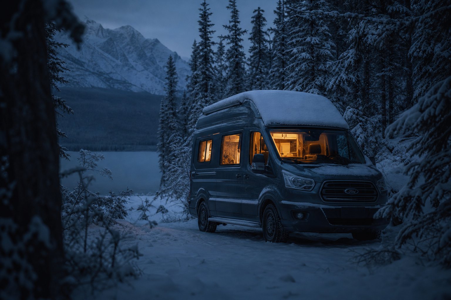
3. Commit to a real Canadian winter. If you're staying somewhere genuinely cold, this stops being a routing question and becomes a survival systems question — heat, condensation, frozen lines, cold-derated batteries, and a CO alarm that is not optional. Do not improvise it. Read [winter van living in Canada](winter-vanlife.md) before the first hard freeze, not during it.
The one thing winter routing can't fix: the far north and most forest roads are simply gone as options from late fall to late spring. Winter is a south-and-coast game.
A simple mental model for the whole year
You don't need a spreadsheet. Carry this:
- April–May: stay south and on hard surfaces; mud season and breakup. Bugs starting.
- June: stage north; black flies peaking in the bush — favour breezy, open country.
- July–August: the north is open and comfortable; do the hard-to-reach legs now. Mosquito peak in the south.
- September: the best shoulder; start drifting south, get out of the deep north before freeze-up.
- October: mid-latitude gold; ferries and northern roads closing.
- November–March: mild coast (wet) or south-inland (cold, serviced) or a committed winter build.
Everything else is detail. The country tells you where to be — your job is to listen to the calendar and have your access windows confirmed before you turn the key. Seasonal dates shift every year with weather; treat every window here as a planning estimate and confirm the live road, ferry, and ban status against the official source before you rely on it.
Sources
- Friends of Algonquin Park — Mosquitoes & Black Flies (biting insects): https://www.algonquinpark.on.ca/visit/park_management/mosquitoes-and-blackflies-(biting-insects).php
- The Dempster Highway — Driving Seasons (ferry / break-up / freeze-up windows): https://www.dempsterhighway.com/driving-seasons
- Government of NWT, Infrastructure — Ferries: https://www.inf.gov.nt.ca/en/ferries
- 511 Yukon — live road and ferry conditions: https://511yukon.ca/
- Marine Atlantic — Sailing schedule (seasonal Argentia service): https://www.marineatlantic.ca/sailing-information/schedule
- Government of Newfoundland and Labrador, Transportation & Infrastructure — St. Barbe / Blanc-Sablon (Strait of Belle Isle) ferry: https://www.gov.nl.ca/ti/ferryservices/schedules/j-pollo/
- Labrador Marine — Strait of Belle Isle service: https://labradormarine.com/
- TranBC (BC Ministry of Transportation and Transit) — Seasonal Load Restrictions (spring breakup / frost laws): https://www.tranbc.ca/2022/05/31/seasonal-bc-load-restrictions-answering-trucking-questions/
- DriveBC — live road and seasonal load restrictions: https://www.drivebc.ca/
- Climate of Vancouver (Wikipedia, summarizing Environment Canada climate normals) — south-coastal winter mildness and January rainfall: https://en.wikipedia.org/wiki/Climate_of_Vancouver
Seasonal windows, ferry seasons, road openings, and frost-law dates vary year to year with weather and are set by the responsible province or territory. Every date in this guide is a planning estimate — confirm the live status against the official source before your trip.