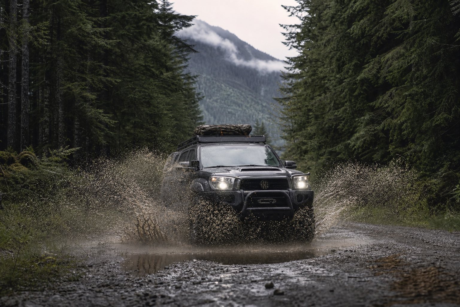
The pavement ends and the real map begins. Forest-service roads, resource roads, logging mains, and old mining-access tracks are how a nomad reaches the country worth reaching — the Crown-land spots, the trailheads, the lakes with no campground attached. But these roads were not built for you. They were built to haul logs, ore, and drilling rigs, and they are maintained (or abandoned) on an industrial schedule that has nothing to do with your trip.
Drive them like the working roads they are and they'll take you a long way. Treat them like a wider highway and they'll strand you, or worse. Here's how to read them, talk on them, and get yourself unstuck.
Read the road class before you commit
A resource road is not one thing. The same "FSR" label covers a freshly graded gravel main you could take a sedan down and a washed-out spur that hasn't seen a grader since the last cutblock closed. The road's class tells you which.
Most provinces grade resource roads by design standard and traffic. In British Columbia, that runs from a wide, ditched, well-surfaced mainline down through secondary and spur roads to "wilderness" roads that may be deactivated — water bars dug across them, culverts pulled, bridges removed. A deactivated road is not a shortcut; it's a road the manager has deliberately put out of service, and pushing past the barrier is how people end up high-centred miles from help.
Practical reading, regardless of province:
- Mainlines are wide, crowned, and ditched, built for loaded truck traffic. Generally the safest and best-maintained — and the busiest.
- Secondary and spur roads narrow fast, lose their crown, and may be single-lane with infrequent pullouts.
- Branch / wilderness / deactivated roads can be impassable without warning. Brush closes in, the surface breaks up, and a "road" on an old map may simply be gone.
Maintenance is tied to active industrial use, not to recreation. When the cutblock is logged out, the road that served it stops being maintained — sometimes the same season. A track that was clear last year can be alder and washout this year. The map age matters more than the map detail. Provincial road-status and FSR layers (BC's iMapBC and forest-tenure road datasets, for example) are more current than a printed atlas, but nothing beats eyes on the surface in front of you.
Radio-controlled resource roads: how to call the km boards
This is the single most important skill for staying alive on a BC backroad, and the convention is similar across other provinces' industrial roads. Many resource roads are radio-controlled (or "radio-assist"): traffic announces its position over a designated radio channel so a loaded truck barrelling around a blind corner knows you're there before it's on top of you.
How the system works in British Columbia, where it's most formalized:
- The province standardized a bank of dedicated resource road (RR) channels — 35 road channels plus a set of loading-area channels — so anyone can pre-program their radio and switch to the correct channel for the road they're entering. (Source: Government of B.C., resource road radio communications; Four Wheel Drive Association of BC, Backcountry Communications.)
- The active channel is posted on a sign at the start of the road (and often at junctions). You set your radio to that channel before you drive in. A posted channel on a sign overrides anything printed on a map.
- You call your kilometre and direction as you pass the km boards mounted along the road. The protocol defines "Up" as travelling toward increasing kilometre numbers and "Down" as travelling toward decreasing numbers. By default you call every km board in both directions; where traffic is heavy, the protocol's even/odd convention has "Up" traffic call the odd-numbered boards and "Down" traffic call the even-numbered boards so the two directions don't talk over each other. The older terms "Loaded" and "Empty" are still widely heard and accepted. (Source: Government of B.C., A Radio Communications Protocol for Resource Roads in BC.)
Calling rules vary by road, so read the sign and follow what's posted — some roads ask for every km, others use the even/odd split. A call sounds like: "[Road name], kilometre 12, up" — said clearly, then you listen for anyone calling down toward you. Keep the channel for location, direction, and hazards only. It is a safety channel, not a chat frequency.
A few hard truths that keep you alive out there:
- On most public resource roads, radio use is "not mandatory" — but that doesn't make it optional in practice. The B.C. government itself states that "most resource roads are 'radio assist' and use of mobile radios for communicating location and direction is not mandatory," and warns against relying solely on radio because not everyone is carrying one. (Source: Government of B.C., resource road radio communications.) On a blind, single-lane logging main, a radio is the difference between a safe pass and a head-on. Carry one and use it — and still drive every blind corner like someone silent is coming the other way.
- Industrial traffic effectively owns the road. A loaded truck can't stop or maneuver the way you can. Assume it won't, can't, and isn't expecting you. When you hear one coming, find the next pullout and wait — don't try to make the next corner first.
- Use the right radio. The RR channels are VHF business-band frequencies. Transmitting on them in Canada requires a radio licence from Innovation, Science and Economic Development Canada (ISED) — roughly $40–50 a year per radio under the Radiocommunication Regulations — and a radio certified for those frequencies (a user-programmable handheld generally can't be licensed for them). A handheld "FRS" bubble-pack walkie-talkie is not the same thing and won't reach the channels or the range you need. (Sources: ISED radio licensing; West Coast Placer, "How To Program Your Radio for BC's Backroads.")
Outside BC, the formality varies, but the principle is universal: on any active industrial road, listen, announce, and yield to the working traffic.
Tire pressure: air down for the surface, then air back up
Gravel, washboard, soft sand, and loose rock all punish a tire inflated for the highway. Dropping pressure — "airing down" — flattens and lengthens the contact patch, which does three things: more traction on loose surfaces, a softer ride that saves your suspension (and your fillings) on washboard, and a tire that conforms around rocks instead of getting punctured by them.
General starting ranges (these are aftermarket and off-road consensus figures, not a single manufacturer spec — your tire, wheel, load, and vehicle weight set the real floor):
- Graded gravel / washboard: a modest drop, often into the low-to-mid 20s psi, smooths the ride and improves grip without much risk.
- Soft sand or deep loose gravel: lower still — many run 15–20 psi for flotation so the tire rides on top instead of digging in.
- Rock: around 15–20 psi lets the tire wrap and protect the sidewall.
Two rules that aren't optional:
- Don't go too low. Below a certain point the tire can de-bead — peel off the rim — especially in a hard corner or on a side-slope. Without beadlock wheels, treat the high-teens psi as a sensible floor for a loaded van or truck, and go lower only with experience and a way to re-inflate.
- You must be able to air back up. Low pressure is for low speed on the rough stuff. The moment you hit firmer road or pavement, an under-inflated tire builds heat and fails. Carry a 12 V compressor (or a CO₂ system) and reinflate to road pressure before you speed up. Airing down without the means to air up is how a good shortcut becomes a tow bill. (Source: off-road tire-pressure guidance, JACO / MetalCloak airing-down guides.)
A simple field method: drop about 10 psi from your road pressure to start, and if you're still spinning, take another 10% off in 2–3 psi steps until you have grip — then write down what worked for next time.
The self-recovery kit: get yourself unstuck
Out past the grid, nobody is coming for hours, and cell coverage is gone. The whole point of a recovery kit is that you don't need a second vehicle or a winch to handle the situations you'll actually hit. Four items cover the large majority of stucks:
- Traction boards (the recovery ramps that wedge under a spinning tire). The single most useful recovery tool you can carry — they work solo, need no skill, and pull you out of sand, mud, and snow. Place under the tire, drive out gently, retrieve.
- A folding shovel. You clear material from around the tires before the boards will bite, and dig out when you're high-centred on a berm or rock. Boards plus a shovel solve most boggings.
- A kinetic recovery strap (or rated tow strap) plus rated soft shackles or shackles. For the times another vehicle is around to pull you. Use a tree-saver strap (a wide strap, not a chain or a thin rope) if you anchor to a tree, and rated, corrosion-resistant hardware — forest country eats cheap steel.
- Gloves, and a way to air back up. Already covered, but the compressor lives in this kit too.
Two safety notes that matter more than the gear list: never use a ball hitch or a non-rated hook as a recovery point — under a kinetic snatch load a failed point becomes a projectile — and keep bystanders well clear of any strap under tension. A recovery strap that lets go can kill.
(Source: off-road recovery-gear guidance; Truck Camper Magazine, "Essential Off-Road Recovery Gear.")
Tread Lightly and Leave No Trace, for vehicles
Vehicle access to the backcountry is a privilege that closes fast when it's abused. Every washed-out shortcut, every mud-bogged meadow, every fresh two-track cut around a puddle gives a land manager a reason to gate the road. The ethic that keeps these roads open is Tread Lightly! — the vehicle-specific complement to Leave No Trace. Its five principles spell T.R.E.A.D. (Source: Tread Lightly!, T.R.E.A.D. Principles, treadlightly.org):
- T — Travel Responsibly on land by staying on designated roads, trails, and areas. Don't cut new tracks; don't drive around obstacles and widen the trail — that's how a single rut becomes a braided scar.
- R — Respect the Rights of Others including private-property owners, other recreational users, and the industrial traffic whose road you're on, so everyone can use it undisturbed.
- E — Educate Yourself before the trip by getting current maps and regulations from the managing agency, planning your route, and knowing how to operate your vehicle and recovery gear safely.
- A — Avoid Sensitive Areas on land such as meadows, lake shores, wetlands, and streams. Wet soils rut and scar for years; cross water only at designated, hardened fords.
- D — Do Your Part by leaving the area better than you found it: pack out your waste (and a bit of someone else's), minimize fire, don't spread invasive species — rinse mud off before moving between watersheds — and report damage or blockages to the managing agency.
The T.R.E.A.D. principles are non-proprietary, and Canadian clubs and land agencies adopt them directly. They line up cleanly with Leave No Trace's vehicle guidance — stay on durable surfaces, keep 30+ m from water when you camp, pack out everything. On a forest road that means: don't deepen ruts, don't make new ones, and don't be the reason the gate goes up.
Fuel and range discipline: the deep-spoke math
The grid that makes minimalism work in town disappears the instant you turn onto a forest road. There is no fuel out the spoke, and the rough surface, low gears, and climbing all burn it faster than the highway. Range discipline is what keeps a backroad trip from becoming a survival situation.
The working numbers:
- Plan on your tank doing less than you think. Soft surfaces, low-range crawling, idling for recovery, and elevation gain can cut real-world economy substantially below your highway figure. Treat your usable range as well under the brochure number.
- Turn around at a third, not a half. The old bush-pilot rule applies to fuel on a dead-end spur: a third of your fuel to push in, a third to get back, a third in reserve for the wrong turn, the washout reroute, or the recovery that eats an hour of idling. If you're past a third gone and haven't reached the spot, the spot can wait.
- Top up at the last grid node. Fuel to full at the town hub before you commit to the spoke — the same hub-and-spoke logic that governs water, propane, and dump. The deeper the spoke, the bigger the buffer: extra fuel in a proper rated container, more water, a real recovery kit, and the spare part.
- Carry fuel safely or not at all. Spare fuel rides in a certified jerrican, secured and vented per its design, never in an open container in the cabin. If you can't carry it safely, your range is your tank — plan the trip around that.
This is the dial from the Just-In-Time logic turned all the way toward autonomy. In town you run lean because the warehouse is across the street. Out the spoke, the warehouse is your own tanks and bins, and range is the hard limit that decides how far the country opens up to you.
Conditions on resource roads change constantly — active hauling, deactivation, washouts, and seasonal gates. Always check the current road status and active radio channel with the provincial agency or licensee before you drive in, and tell someone your route and return time. The backcountry forgives preparation and punishes assumption.
Sources
- Government of British Columbia — Resource road radio communications (radio "assist"/not mandatory status; standardized channel bank; calling location and direction): https://www2.gov.bc.ca/gov/content/industry/natural-resource-use/resource-roads/radio-communications
- Government of British Columbia — A Radio Communications Protocol for Resource Roads in BC ("Up" = travel toward increasing km boards; default call every km; even/odd split where used — Up calls odd, Down calls even; Up/Down vs Loaded/Empty): https://www2.gov.bc.ca/assets/gov/farming-natural-resources-and-industry/natural-resource-use/resource-roads/radio_communications_protocol_for_res_rds_in_bc_pilot_proj_results__recommend_for_implementation.pdf
- Government of British Columbia — Resource road radio channel maps (channel programming, channel-assignment maps, posted channels supersede maps): https://www2.gov.bc.ca/gov/content/industry/natural-resource-use/resource-roads/radio-communications/channel-maps
- Four Wheel Drive Association of BC — Backcountry Communications (35 RR road channels plus loading channels): https://4wdabc.ca/our-projects/communications/
- Innovation, Science and Economic Development Canada (ISED) — Radio licensing and RR — British Columbia Resource Road Channels (licence required for VHF business-band RR channels; fees set under the Radiocommunication Regulations, adjusted annually): https://ised-isde.canada.ca/site/spectrum-management-telecommunications/en/licences-and-certificates/radio-authorizations/radio-licensing
- West Coast Placer — How To Program Your Radio for BC's Backroads (annual per-radio licence cost; certified VHF radio requirement vs. user-programmable handhelds): https://www.westcoastplacer.com/program-your-radio-for-bcs-backroads/
- Tread Lightly! — T.R.E.A.D. Principles (Travel Responsibly, Respect the rights of others, Educate yourself, Avoid sensitive areas, Do your part): https://treadlightly.org/education/tread-principles/
- JACO Superior Products — The Ultimate Guide to Airing Down Tires for Off-Roading (deflation ranges, de-bead and re-inflation cautions): https://jacosuperiorproducts.com/blogs/news/the-ultimate-guide-to-airing-down-tires-for-off-roading-why-when-and-how
- MetalCloak — The Ultimate Guide to Off-Road Tire Pressure (terrain-specific psi ranges): https://metalcloak.com/blog/airing-down-101
- Truck Camper Magazine — Essential Off-Road Recovery Gear for Campers (traction boards, shovel, rated straps/shackles, recovery-point safety): https://www.truckcampermagazine.com/question-of-the-week/essential-off-road-recovery-gear-campers/